
Cadastre of the comas district dwg
.")
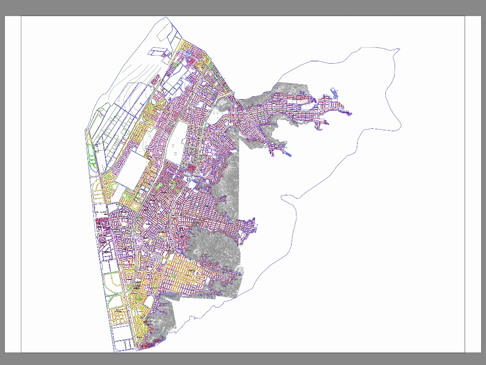
This cadastral map represents a fundamental tool for the territorial analysis and urban management of the comas district, located in the northern cone of metropolitan lima. through a detailed and updated representation of lots, roads, public spaces, and urban amenities, it technically visualizes the physical structure of the district, allowing for an understanding of its urban morphology and its evolution over time. this map not only delineates property ownership and land use, but also demonstrates the dynamics of urban growth, the consolidation of human settlements, and the relationship between existing infrastructure and future planning needs. its preparation responds to technical criteria based on official cartography, georeferenced coordinates, and regulations of the national integrated cadastre and registry system. this input is key for decision-making by local authorities, as well as for territorial planning studies, infrastructure projects, property valuation, and architectural planning. furthermore, its documentary and analytical value makes it an indispensable source for the sustainable development of the district, promoting a more orderly city. equitable and resilient.