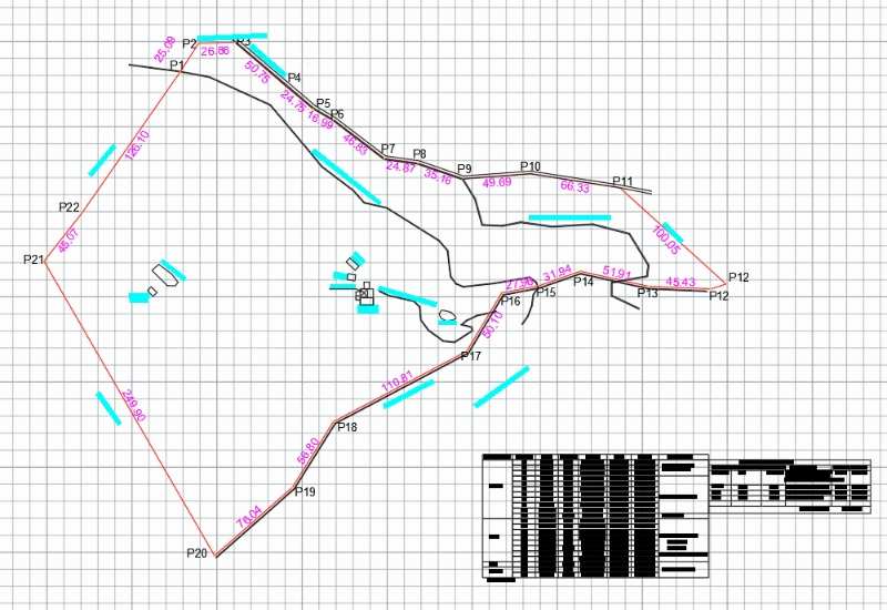
In this drawing, the planimetry of a property has been made with the existing constructions and existing characteristics; the data was taken with gps and the coordinates of each point are recorded
Confirma el mail en Facebook e intenta nuevamente.
Confirma el mail en Google e intenta nuevamente.
Your account is inactive. To request a reactivation you can contact us by email atsoporte@bibliocad.com.
