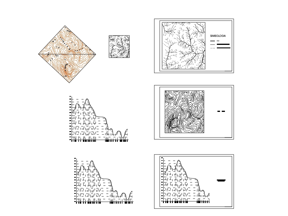
It is a plan of a topographic configuration, extracted from a photogrammetric map and from which a diagonal line is drawn and its profile is made, this in order to identify the existing runoffs.
Confirma el mail en Facebook e intenta nuevamente.
Confirma el mail en Google e intenta nuevamente.
Your account is inactive. To request a reactivation you can contact us by email atsoporte@bibliocad.com.

.")